 简体中文
简体中文 English
 繁体中文
繁体中文

Xinjiang Uyghur Autonomous Region, abbreviated as "Xin", with its capital in Urumqi City, is located on the northwest border of China and is one of the five ethnic minority autonomous regions in China. Covering an area of 1.66 million square kilometers, it is the largest provincial-level administrative region in China's land area, accounting for one sixth of China's total land area. It is slightly larger than the 13 provinces and cities of Henan+Shandong+Hebei+Beijing+Tianjin+Shanxi+Shaanxi+Hubei+Anhui+Jiangsu+Shanghai+Zhejiang+Hunan combined!
Xinjiang is vast and rich in resources, with numerous delicacies, oases scattered everywhere, and vast deserts. If you are visiting Xinjiang for the first time, would you like to know what are the beautiful attractions? How many days do you have enough time to play? How many days can I play with limited time? Where is Southern Xinjiang? Where is Northern Xinjiang? How many 5A level scenic spots are there in Xinjiang? This travel guide can provide you with answers!Overview of Cities in Xinjiang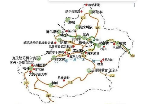
In Xinjiang, the Tianshan Mountains divide Xinjiang into two different customs! To the north of Tianshan is the northern Xinjiang, and to the south of Tianshan is the southern Xinjiang. The north and south of Xinjiang have completely different styles!
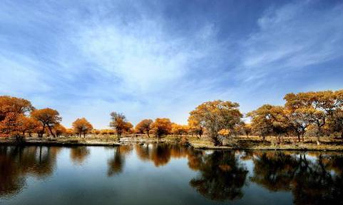
Northern Xinjiang is mainly characterized by natural scenery, and some famous scenic spots include (attached introduction)
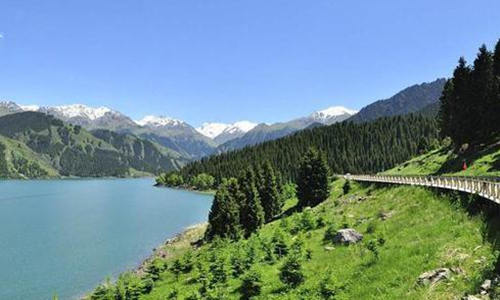
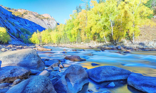
Tianshan Tianchi
The Tianshan Tianchi Mountain Tianchi Scenic Area, centered around Tianchi Lake, includes four complete vertical mountain natural landscape belts above and below Tianchi Lake, with a total area of 380.69 square kilometers. The surface of Tianchi Lake is half moon shaped, with a length of 3400 meters, a maximum width of about 1500 meters, an area of 4.9 square kilometers, and a maximum depth of about 105 meters. The lake water is clear and crystal clear like jade. Surrounded by mountains, green grass and wild flowers, it is renowned as the "Pearl of the Tianshan Mountains". Tall and verdant spruce and pine trees cover the mountains and mountains, blocking the sky and sun.
Keketuohai
Keketuohai Scenic Area and Keketuohai National Geopark are located in Fuyun County, Altay Prefecture, northern Xinjiang. The scenic area is mainly composed of the Karaxiangel earthquake fault zone, Kekesuli, Iremu Lake, and the Erzis Grand Canyon. It integrates beautiful natural scenery such as the river source scenery, swamp wetland landscape, cold polar lakes, geological and mineral resources, and integrates cultural landscapes such as grassland nomadic culture, Western ethnic customs, and regional characteristics. It offers sightseeing, leisure vacation, and special tourism (hiking, photography, etc.) Tourist attractions with scientific research as their main features
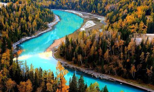
Kanas
"Kanas" is a Mongolian language, meaning "beautiful and mysterious lake". Kanas Lake is located in the northern part of Burjin County, Altay Prefecture, Xinjiang Uygur Autonomous Region. The lake water comes from glacial meltwater from Kuitun, Youyi Peak and other mountains, as well as local precipitation. The lake has an elevation of 1374 meters and an area of 45.73 kilometers ², The deepest elevation of the lake is 1181.5 meters, with a depth of 188.5 meters and a storage capacity of 5.38 billion cubic meters. It is the deepest glacial barrier lake in China and is a high mountain lake and inland freshwater lake located in the deep mountains and dense forests of Altai.
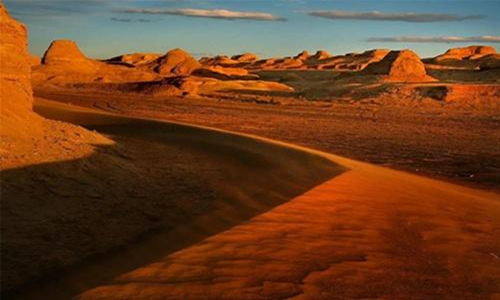
Urhe Devil City Devil City
Also known as Urhe Wind City. Wuerhe mining area is located in the lower reaches of Jiamu River at the northwest edge of the Junggar Basin, Xinjiang Uygur Autonomous Region, 100 kilometers southwest of Karamay City. There is a unique wind eroded landform with a strange shape. The local Mongolian people call this city "Surumhak", and the Uyghur people call it "Shaitankerxi", which means Devil's City. In fact, this is a typical Yadan landform area. "Yadan" means "steep hill" in Uighur. Yadan landform is named after Yadan area near Lop Nur in Tarim Basin, Xinjiang, which is a wind erosion landform formed under dry and windy environment.
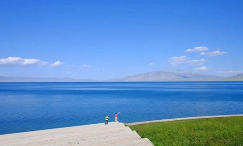
Sailimu Lake
Sayram Lake is a provincial-level tourist attraction and the fifth batch of national scenic spots. It is the highest and largest mountain lake in Xinjiang, with beautiful scenery. It is also the last place favored by warm and humid Atlantic air currents, hence the saying "the last tear of the Atlantic".
Sailimu Lake, formerly known as "Clean Sea", is located in the northern Tianshan Mountains of Bole City, Bortala Prefecture, Xinjiang, adjacent to Huocheng County, Ili Prefecture. The lake has an elevation of 2071 meters, a length of 30 kilometers from east to west, a width of 25 kilometers from north to south, an area of 453 square kilometers, and a storage capacity of 21 billion cubic meters. The lake water is clear and transparent at the bottom, with a transparency of 12 meters
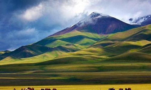
Nalati
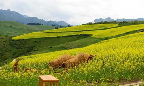
The Nalati Grassland is a mid mountain grassland developed on the ancient alluvial layers of the 3rd period. It is bordered by the Nalati Mountains in the southeast, forming a barrier like terrain, and is broken off along the upper reaches of the Gongnaisi River in the northwest. The Nalati grassland is a subalpine meadow plant, composed of lush and colorful intermediate weeds and grasses, with a plant height of 50-60 centimeters and a coverage rate of 75-90%. In mid spring, the grass is tall and the flowers are flourishing, and the lush green grass is extremely beautiful.
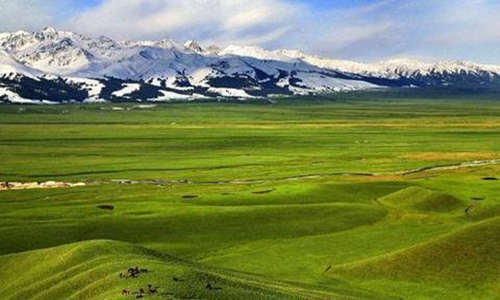
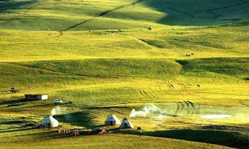
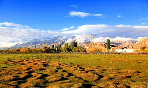
Bayinbuluke
The Bayinbuluke Grassland is located in a mountainous basin in the northwest of Hejing County, Bayingolin Mongolian Autonomous Prefecture, Xinjiang, and in the middle of the Tianshan Mountains. It is surrounded by snow capped mountains, with an altitude of about 2500 meters and an area of 23835 square kilometers. It is the second largest grassland in China, second only to the Hulunbuir Grassland in Inner Mongolia. Bayinbuluke Mongolian means "rich spring water". The grassland has a flat terrain and abundant water and grass, making it a typical grassland and one of the most important animal husbandry bases in Xinjiang. There is not only a paradise surrounded by snow capped mountains, but also the Kaidu River with its nine curves and eighteen bends, and the elegant and charming Swan Lake.
Southern Xinjiang is mainly characterized by cultural charm, and some famous scenic spots include (attached introduction)
The Mysterious Grand Canyon of Tianshan
The mysterious Grand Canyon of the Tianshan Mountains, surrounded by mountains at the southern foot of the Tianshan Mountains, combines the wonders of the human canyon with the wonders of the Tianshan Mountains, embodying the spirit of the ages and integrating the divine, extraordinary, dangerous, majestic, ancient, and secluded into one. The scenery is peculiar and fascinating. The Grand Canyon is approximately in a north-south arc, with a slight southeast bend at the opening and a slight northeast bend at the end. It consists of the main valley and seven tributaries, with a total length of over 5000 meters. The natural drop from the end of the valley to the mouth of the valley is over 200 meters. The widest part of the valley is 53 meters, and the narrowest part is 0.4 meters. Only one person can bend their head and body to pass through it. The rugged peaks on the valley side compete to rise; The peaks are stacked, the earth is towering, and the cliffs are steep and majestic.
Luobu Village
It is one of the oldest ethnic groups in Xinjiang, living on the banks of the Tarim River in Xiaohaizi. They do not grow grains or graze livestock, but only feed on small boats for fishing. The Luobu dialect is one of the three major dialects in Xinjiang, and its folk customs, songs, and stories have unique artistic value. The Luobu Village Scenic Area takes Luobu culture as its soul, ecological construction as its foundation, comprehensive resource development as its goal, and folk culture and adventure tourism as its characteristics. It is a tourist area that integrates deserts, Populus euphratica, rivers, and lakes, with diverse natural scenery and beautiful ecological environment.
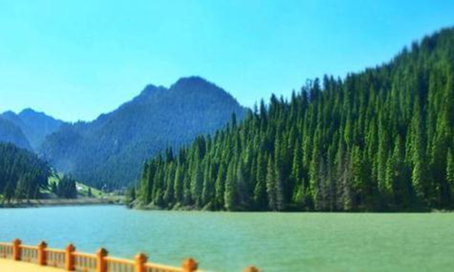
Bosten Lake
It is the largest freshwater lake in Xinjiang, located in the southeast of Bosteng Lake in the Yanqi Basin on the southern slope of the Tianshan Mountains in Bohu County, Bayingolin Prefecture. It is the largest inland freshwater lake in China. Bosten Lake, with a total area of 1646 square kilometers, coexists with snow capped mountains, lake light, oases, deserts, exotic birds, and exotic animals, creating a rich and colorful landscape. The vast waters of the Great Lake, with misty waves and a harmonious sky and water, are known as a pearl in the vast desert sea. Xiaohu District, with lush reeds and fragrant lotus, and deep winding paths, is known as the "Peach Blossom Land".
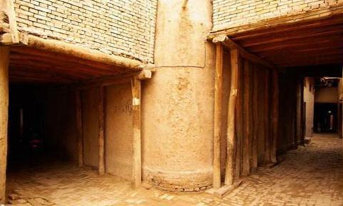
Kashgar Ancient City
With a long history, rich culture, and unique customs, it is known as "not to Kashgar, not to Xinjiang, not to the ancient city, not to Kashgar". Kashgar Ancient City, as a brilliant pearl on the ancient Silk Road and the intersection of Eastern and Western civilizations, is shining with new charm with an open and inclusive attitude and a rich history.
Within the scenic area, there are distinctive folk customs such as Impression Street, Iron Industry Commune, Uyghur Medical and Pharmaceutical Bazaar, Flower Hat Bazaar, Etigar Square, Wusitang Boyi Road Millennium Ancient Street, and Centennial Old Tea House. There are also emerging business formats that integrate modern civilization and ancient culture, such as Corner Cafe, Jiulongquan Commercial Block Homestay, Bagqi Lane Homestay, and Travel Photography. There are also exciting performances such as the opening ceremony, camel caravan parade, and Western Region Princess Selection, There are also popular check-in points such as Rainbow Alley and Budai Alley, as well as Hanbazaar cuisine that leaves people lingering.
Id Kah Mosque
The total area of the temple is 16800 square meters, consisting of a chapel, a scripture hall, a gatehouse, and other ancillary buildings. The temple gate is made of yellow bricks, with gypsum joints. The gate is 4.7 meters high and 4.3 meters wide, and the gate tower is about 17 meters high. On both sides of the gate tower, there are asymmetrical 18 meter high minarets, each with a crescent moon standing at the top. At dawn every day, Ashikaga in the temple climbs the tower five times and loudly calls for Muslims to come and worship. Behind the gate tower is a large arch in the north, with a spire supporting it at the top. After entering the gate, there is a huge courtyard with flowers, trees, and a pool inside.
Baisha Lake
Baisha Lake was originally the confluence of the Muji River, Brunkou River, and Kangxiwa River. Later, people built dams to intercept the water of the three rivers, forming a plateau artificial reservoir with an area of 44 square kilometers. The mountainous area along the bank of the reservoir is covered with white sand and is called Baisha Mountain. The lake at the foot of the mountain is called Baisha Lake. The lake water is clear and bottomless, appearing very pure under the reflection of the blue sky. On both sides of Baisha Lake, Gongge Jiubie Peak stands in the distance. This beautiful scenery makes the snow capped mountains and lakes, which have been dormant for thousands of years, appear more pure and quiet. It is said that the Liusha River described in Journey to the West is here.
Karakul Lake
Karakul Lake is a plateau lake located at the foot of the Muztag and Gongger Ice Peaks in Bulenkou Township on the Pamir Plateau of Aktau County, just about ten kilometers away in a straight line. However, the scenery of the two lakes is vastly different. Karakul Lake is about 160 kilometers away from Aktao County and 220 kilometers away from Atush City. It has an altitude of 3600 hundred meters, an area of 10 square kilometers, and a depth of over 30 meters. Due to its deep and gloomy water, it is named "Karakul" (meaning black lake in Kyrgyz).
Panlong Ancient Road
Walking outside all year round, I have seen countless beautiful scenery. However, the magnificent scenery of the Panlong Ancient Road located in Waqia Township, Kashgar Kugan County, Xinjiang, still impresses me. We often use the 18 turns of a mountain road to describe the hardships of a road, and the Panlong Ancient Road, which is over 30 kilometers long, has 639 turns, not the world's first, but definitely China's first turning road.
Five A-level scenic spots in Xinjiang
1. Kanas Scenic Area in Altay Region
2. Tianshan Tianchi Scenic Area in Xinjiang
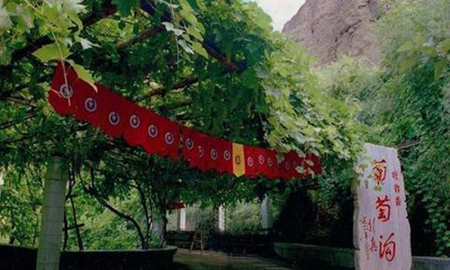
3. Putaogou Scenic Area in Turpan City
4. Altay Region Fuyun Keketuohai
5. Bosten Lake Scenic Area in Bayingolin Mongolian Autonomous Prefecture
6. Baisha Lake Scenic Area of the 10th Division of Xinjiang Production and Construction Corps
7. Nalati Scenic Area in Ili, Xinjiang
8. Kalajun Scenic Area in Ili Prefecture, Xinjiang Autonomous Region
9. Bayin Prefecture and Jingbayinbuluke Scenic Area in Xinjiang Autonomous Region
10. Urumqi Tianshan Grand Canyon Scenic Area
11. Kashgar Old City Scenic Area in Kashgar Prefecture
12. Zepu Jinhu Yangjing District in Kashgar Prefecture
13. Karamay World Devil City Scenic Spot
14. Pamir Tourist Area
15. Sailimu Lake
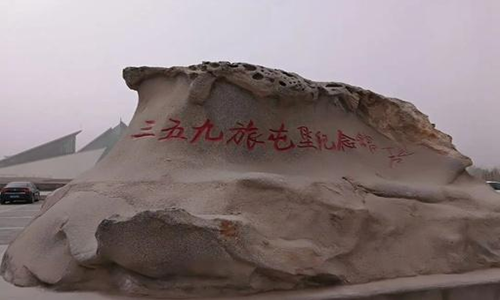
16. Xinjiang Production and Construction Corps Taklamakan · 359th Brigade Cultural Tourism Area
17. Jiangbulake Scenic Area in Changji Hui Autonomous Prefecture, Xinjiang Uygur Autonomous Region
Attending tips:
1. If one or two of you go to Xinjiang, it is recommended to participate in a group tour. You can choose your favorite itinerary for the group tour. Friends from all over the world can ride in a car and chat and have fun together!
2. If you have a large number of people or want to play on your own, it is recommended to choose a chartered car, depart separately, and customize the itinerary according to your requirements, emphasizing freedom!
3. If you have limited time and only have about five days, you can choose to play around Urumqi, such as a 1-day tour of Tianchi, a 2-day tour of Turpan, a 5-day tour of Kanas, etc., or choose to play around Kashgar, such as a 1-5 day tour of Kashta County
4. If you have plenty of time, with 10 days or more, you can choose the South Xinjiang Long Line, North Xinjiang Long Line, and North South Xinjiang Long Line
5. If you want to see the scenery of northern Xinjiang, you can choose the itinerary of Kanas, Hemu, and Ili. If you want to see the scenery of southern Xinjiang, you can choose itineraries such as Kuche, Korla, Aksu, Hotan, Kashgar, etc
Travel tips:
1. Xinjiang belongs to a continental arid and semi-arid region, with different days and distinct four seasons. The scenery and weather of each season are different, and there is a large temperature difference in the morning, middle, and evening. There is a saying that "wear a cotton jacket in the morning, wear gauze in the afternoon, and eat watermelon around the stove." Therefore, friends who come here should timely add or remove clothes according to the daily climate characteristics to prevent colds.
2. The water quality in Xinjiang is relatively hard, and the food is mainly meat and dairy. If you eat meat, do not eat grapes immediately, and do not drink hot water immediately after eating grapes to avoid diarrhea.
3. Many scenic spots in Xinjiang are open-air and have strong ultraviolet rays. Please carry sunscreen and take good care of it with you.