 简体中文
简体中文 English
 繁体中文
繁体中文

In 2019, "Life at Speed" like a dark horse broke into the hearts of the audience;
Five years later, "Fast Life 2" continued to be brilliant. During the Spring Festival of the the Year of the Loong, the audience was aroused to yearn for Xinjiang by the full laugh and shocking Xinjiang scenery;
Let's take a look at the "Flying Journey" prepared by the editor for everyone!

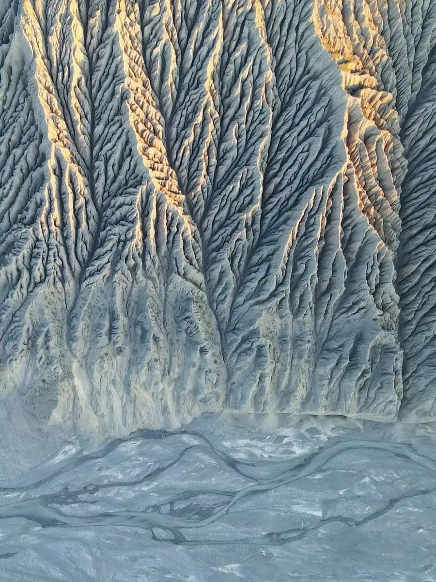
At the end of the film, the scene played by Shen Teng as a racer galloping on the edge of a cliff was filmed live in the Dushanzi Grand Canyon.
When I saw this, my heart was already surging. I wonder if my friends have the impulse to feel this kind of stimulation?
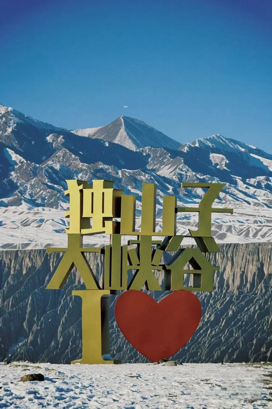
Located in Dushanzi District, Karamay City, the Dushanzi Grand Canyon, known as the "Mystery of Duku and Wonder of Hundreds of Millions of Years", is a canyon landform with an elevation of 1070 meters. The bottom of the valley is 100 meters to 400 meters wide. It is the starting point of one of the most beautiful roads in the country and the first scene of Duku Road.
The Kuitun River, flowing from the snow and water of the Tianshan Mountains, has been scouring Dushanzi for a long time. The canyons on both sides have been washed away by rainwater for a long time, forming a magical scenery canyon. The alluvial gullies formed by the snow and rainwater of the Tianshan Mountains have been carved into orderly arranged road folds on the valley walls, with different shapes.
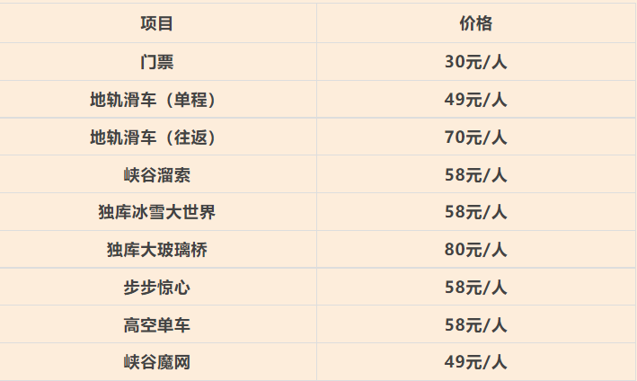
In addition to admiring magnificent and unique landscapes, this place also develops a variety of tourism experience projects for tourists to experience, such as step-by-step thrilling, canyon skating, high-altitude bicycles, and cliff swings.

In Xinjiang, there is a unique road that runs through the Tianshan Mountains, connecting southern and northern Xinjiang. It starts from Dushanzi and ends at Kuche, with a total length of 561 kilometers.
Many road sections are located at an altitude of over 2000-3000 meters, with a maximum altitude of 4558 meters. The roads are winding, rugged, and steep, hovering on the mountainside cliffs.
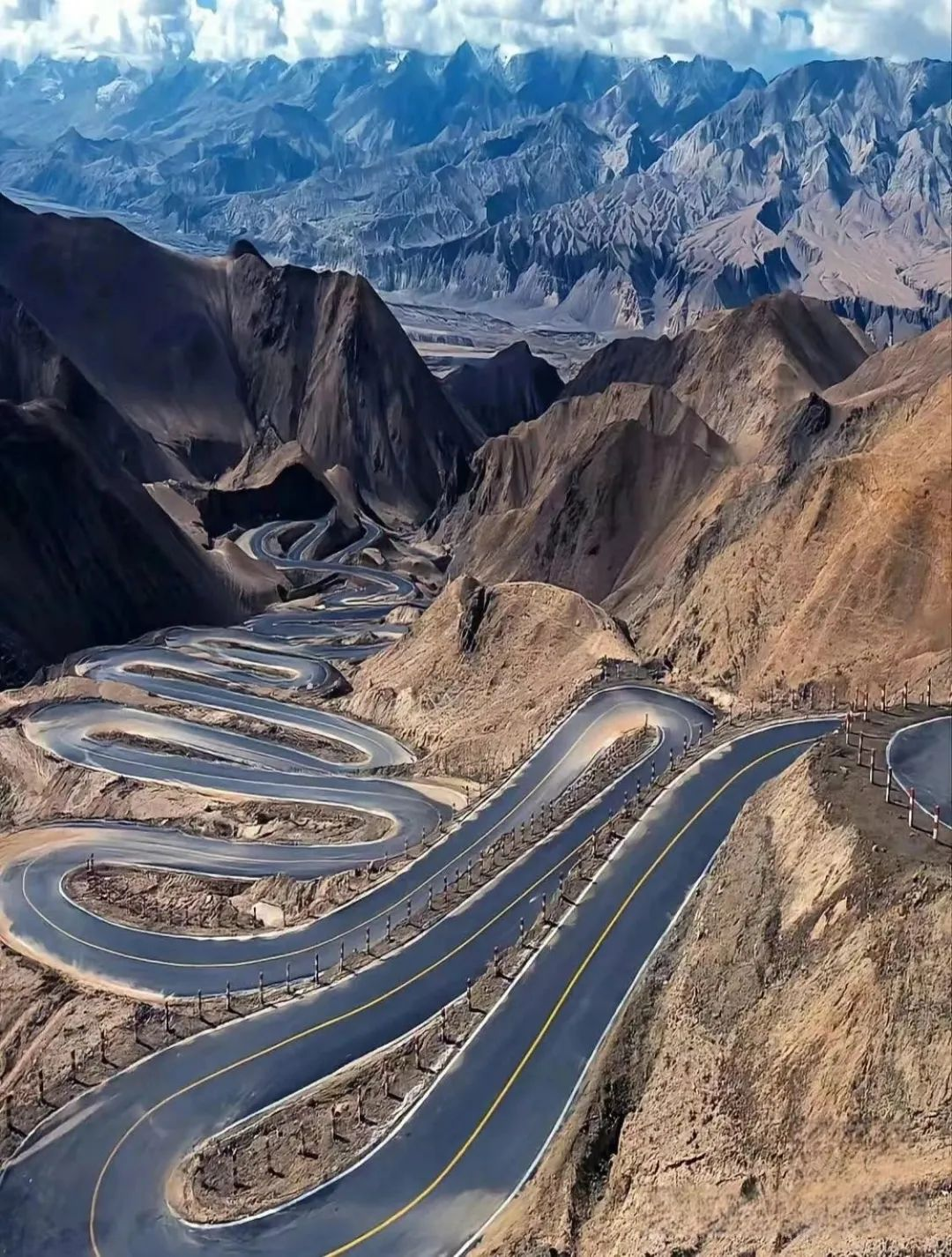
Along the way, there are magnificent snow capped mountains with towering clouds, deep and beautiful river valleys, verdant and towering Tianshan cedars, vast and soothing grasslands, as well as steep and majestic canyon landforms, forming a fantastic scene of "ten miles with different days and four seasons in a day".
It is the Duku Highway, selected by National Geographic of China as the "Landscape Avenue that runs through the backbone of the Tianshan Mountains" and hailed as the "most beautiful and dangerous highway in China".
Self driving on the Duku Highway requires crossing four Daban, with grasslands, forests, snow capped mountains, and red canyons along the way, experiencing spring, summer, autumn, and winter within a day.
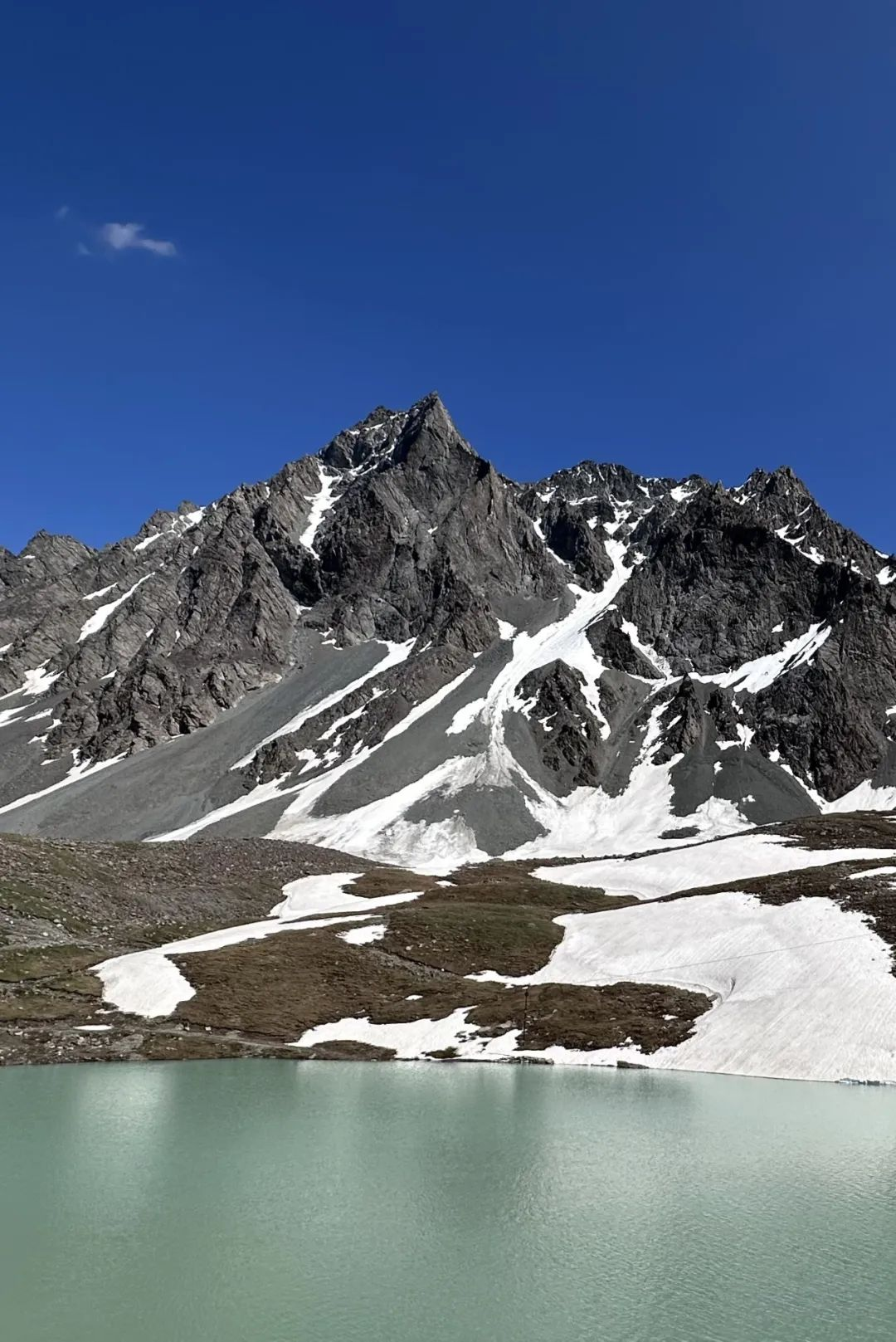
Hashelgendaban is a watershed in the central southern and northern Xinjiang of the Duku Highway, with an altitude of 3450 meters. The glacier tail tongue hanging from the mountaintop extends all the way to the roadside, and the purple red gravel mountain seems to be as high as the sky, looking very spectacular.
Playing Tips:
1. The Duku Highway is affected by climate and is usually open from June to October every year
2. Xinjiang has a large temperature difference, and the Duku Highway is located in a mountainous area, with significant changes in climate temperature within a day. Even in summer, remember to prepare cold resistant clothing.
3. The road has steep slopes and many sharp turns, and the road surface may encounter thin ice and water stains. Please pay attention to the road surface and slow down while driving.
4. There is a dedicated parking area for sightseeing and photography. Please do not park at will. When parking, pull the handbrake to prevent slipping.

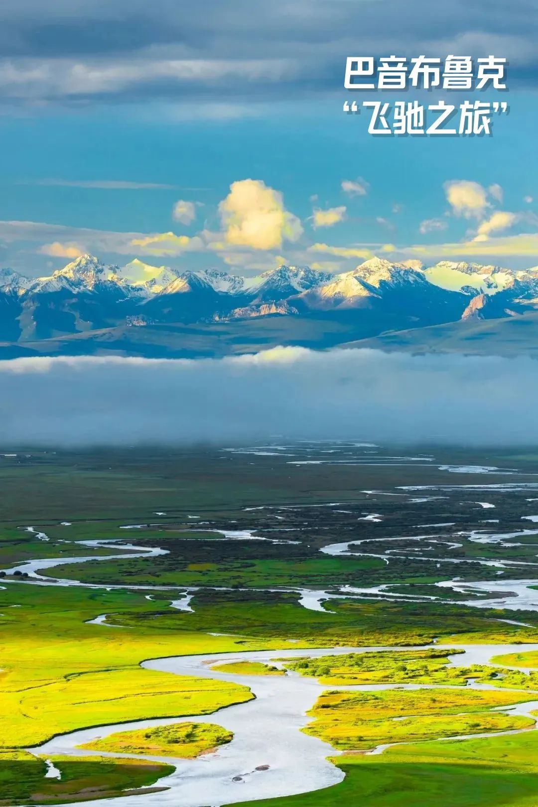
Han Han said: Bayinbuluke has no sea. Only endless gravel and a series of hairpin bends.
And the editor wants to say: Bayinbuluke doesn't have a sea, but it has a snow lotus like top felt house, a flock of sheep wandering like white clouds, and eighteen curves shimmering like fairy ribbons.
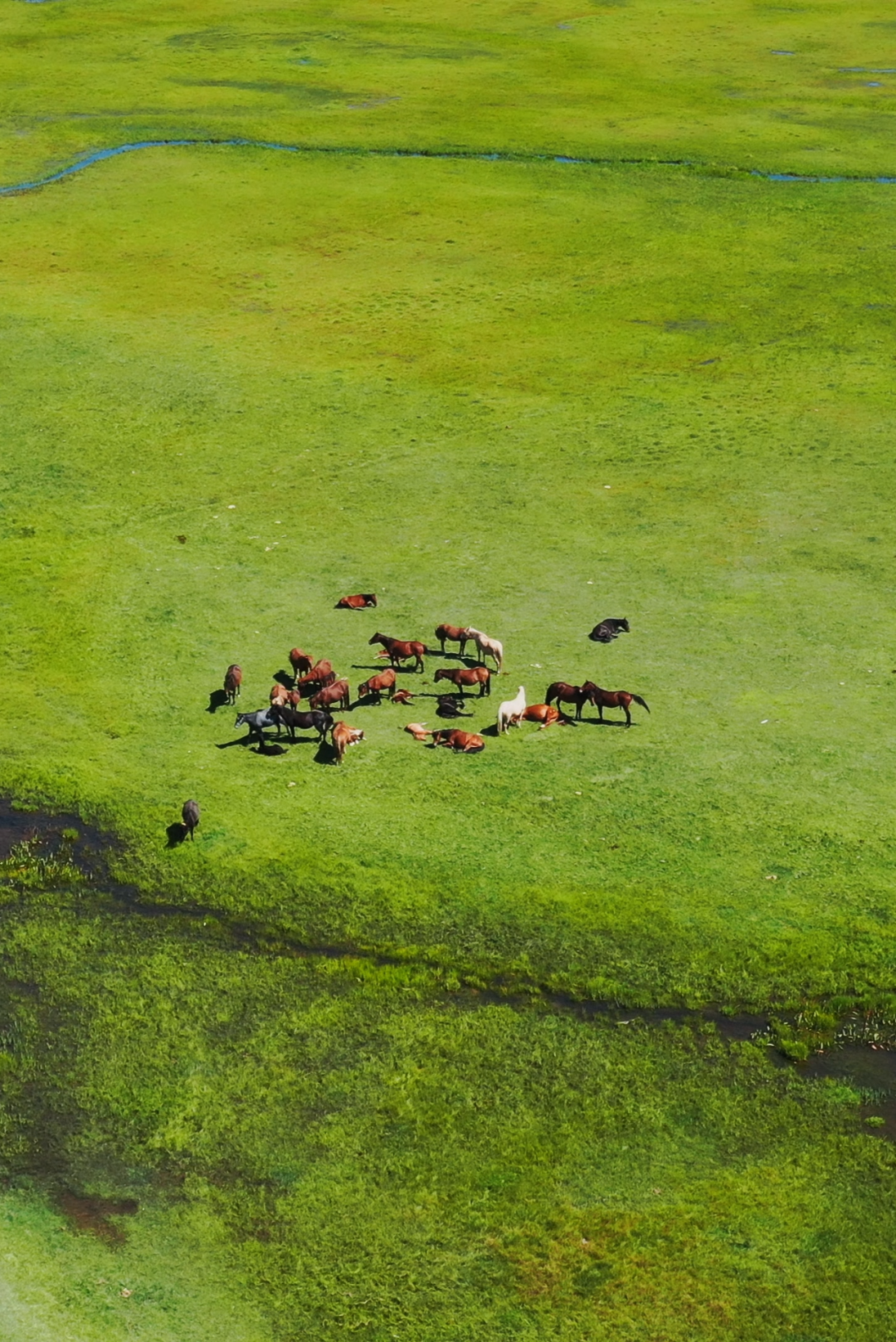
The Bayinbuluke Grassland is located in a mountainous basin in the northwest of Hejing County, Bayingolin Mongolian Autonomous Prefecture, in the middle of the Tianshan Mountains. It is surrounded by snow capped mountains and has an altitude of about 2500 meters. It is the second largest grassland in China.
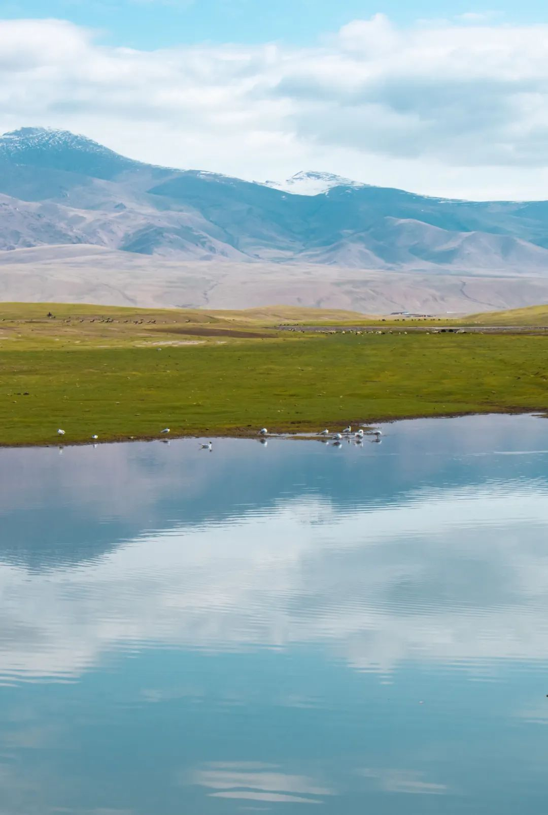
This is a typical grassland and one of the most important animal husbandry bases in Xinjiang. Not only is there a paradise surrounded by snow capped mountains, but also the Kaidu River with its nine curves and eighteen bends, and the elegant and charming Swan Lake.
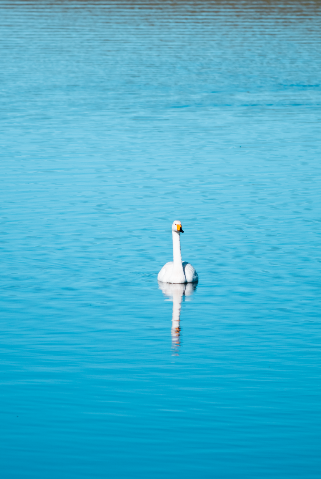
Swan Lake is a natural high-altitude lake, and June is the best season for viewing swans. Tens of thousands of swans, wart nosed swans, little swans, and over 100 rare birds fly in the blue sky and grass, playing in the lakes and clear waters, just like a painting scroll.
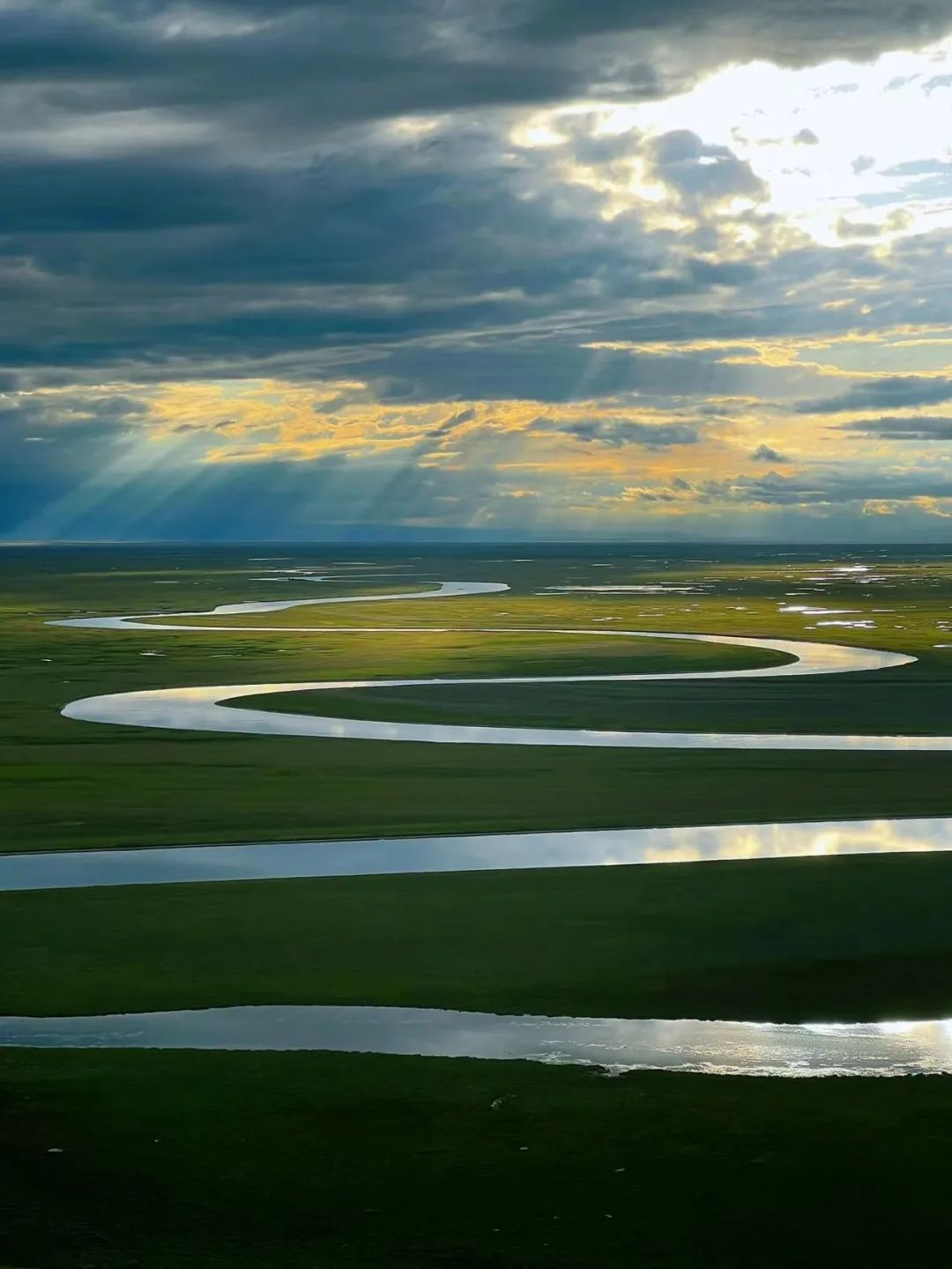
The Kaidu River, winding on the Bayinbuluke grassland, is also known as the "nine curves and eighteen bends". Kaidu River has a total length of 530 kilometers and an area of 22000 square kilometers. It is a river with mixed supply of snow melt water, rainwater and groundwater. It has been published in many domestic and foreign tourism journals such as China National Geography several times.