 简体中文
简体中文 English
 繁体中文
繁体中文

Yili area + Southern Xinjiang big ring line of the 25 days of deep tour
{{item.d}}
¥{{form[item.str].price || 0}}
剩余:{{form[item.str].total || 0}}
Booking process

Overview of itinerary
Product Manager recommendation
During this journey,we will set off together from Yili,the city in the northern border of Xinjiang with the most intact folk culture,surrounded by the enthusiasm of the local people,and head southward. We will enter the vast grasslands,cross highways,and climb mountains,feeling the tranquility of nature in the lakes and being stunned by the breathtaking scenery!
Product characteristics
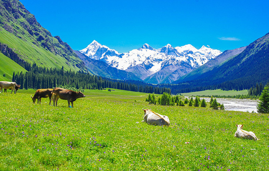
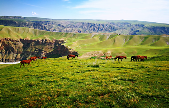
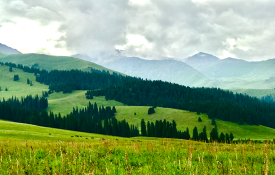
● Enter the world's most beautiful grassland - Naraty grassland,free yourself on the grassland!
● In the Jade Dragon River in Kashgar visitors can experience the joy of jade pickers.
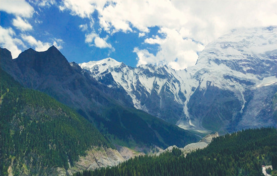
● Cross the Duku Highway amid canyons and glaciers.
● At the foot of the Tian Shan Mountains,feel the magical power of the convergence of the mountain ranges.
● Stand on the shore of the White Sand Lake and feel the fine white sand and soft breeze.
● Cross the Panlong Ancient Road,enter the Pamir Plateau,erase all troubles!
Travel overview
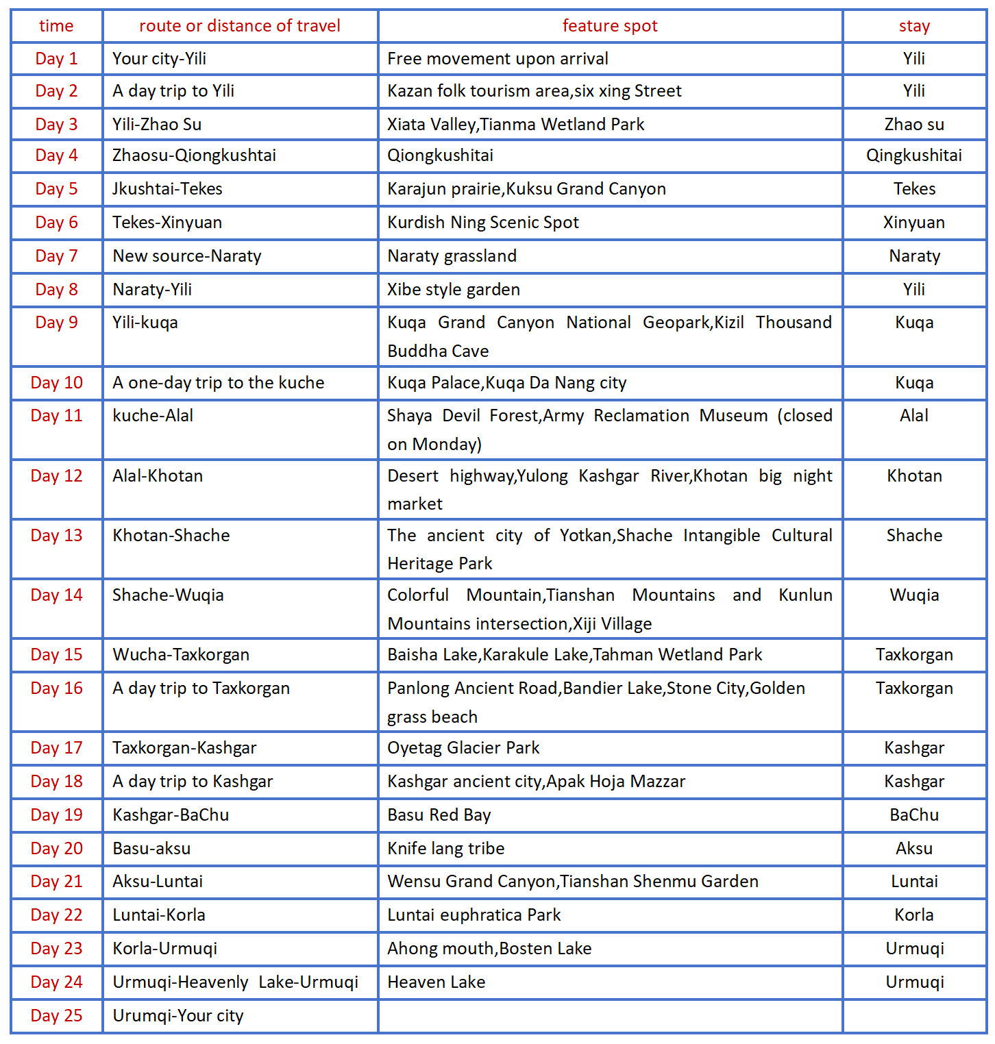
Detailed itinerary
Day 1 Your city-Yili
Welcome to Damei Xinjiang! A professional pickup team will arrange the pickup / train to take you to the hotel for rest. If the time allows you to visit the recommended scenic spots (excluding separate car). The departure time of the next day will be informed by the driver or housekeeper with a message or telephone call before 22:00 PM. Please pay attention to check.
kindly reminder
1. Xinjiang is very large,scenic spots between a long drive,tourism is very physical energy,please bring some food or snacks,in case of emergency;
2. There is a two-hour time difference between Xinjiang and inland,with breakfast around 8-9,lunch around 14 and dinner around 20. For better travel,I hope you can adjust the time clock in Xinjiang as soon as possible.
Day 2 Yili was on a day trip
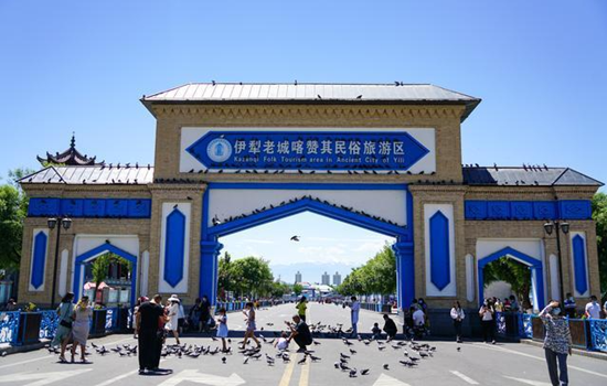
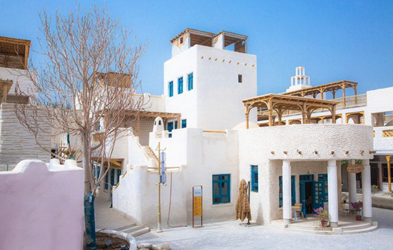
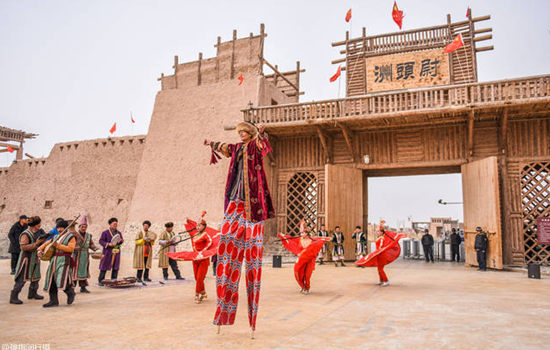
Today's scenic spot: Kazanqi Folk custom tourist area
Yili city to praise its folk tourist area is the only one in northern Xinjiang Uighur ethnic customs as the main body of the large original ecological cultural scenic spot,because it is the window of Yili city image,is also the reality of ethnic customs,it covers the thick Uighur culture,and do not break the northern Xinjiang Uighur national unique folk customs.
For foreign tourists,it is enough to meet their desire to "run in a carriage city" and "feel the ancient traditional folk culture in a modern city". Here still retains the original Uyghur traditional way of life: antique Uyghur dwellings; poetic bridge; tall and simple poplar,mellow milk tea,exquisite cakes,classical,traditional,lively Uyghur wedding; bold,cheerful,warm...
Itinerary
Yili City Kazan its folk tourism area in the characteristic Uygur traditional buildings,not only experience different folk customs,but also many special food waiting for everyone!
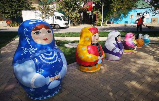
Liuxing Street,the rise of Internet celebrities in recent years,has witnessed the strange cultural symbiosis phenomenon of the combination of foreign culture and local culture.
kindly reminder:
Today in the city travel is easy,can arrange the travel time!
Day 3 Yili-Zhaosu (about 300KM)
Today's attractions:
Xiata Valley
In ancient times,it was a transportation post from Yili to Aksu. The Shata River flowed out from the mountains,opened the flat grassland and flowing into the vast Teks River. Shata Canyon to the river by the mountain pass,ancient road,ancient sites,folk customs and natural landscape,formed an ancient cultural landscape. It is also known as the Tang Monk Ancient Road,and it is said that this is the famous "Gongyue Road" of the Tang Dynasty. The "Ling Mountain" that Tang Xuanzang crossed to the west is here. It is the most precipitous passage on the Silk Road. Along the canyon,it is the remains of the ancient road.
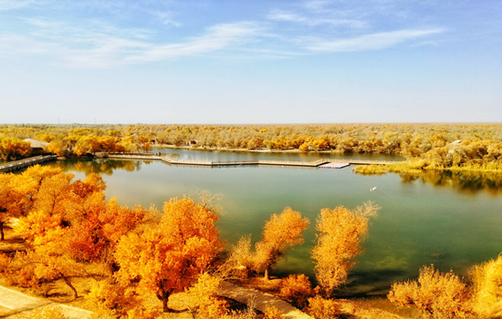
Tianma Wetland Park
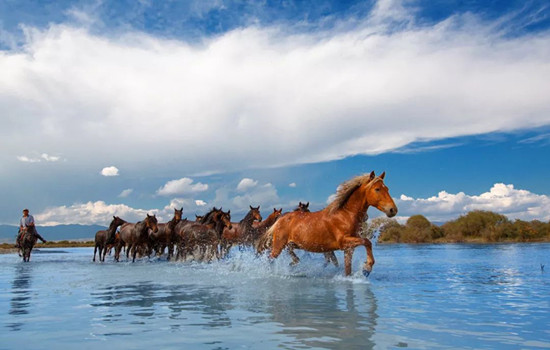
Located in the Zhaosu River Basin,it is the largest natural wetland in Xinjiang and the largest wetland park in northwest China,covering an area of nearly 5,000 hectares. There are various types of wetlands,including swamps,lakes,rivers,etc. The wetlands have rich natural resources and unique ecological environment. And it is known by visitors,in the scenic area of the "Tianma bath River" performance.
This characteristic continues to this day,Zhaosu County is known as "the hometown of Tianma in China" because of its rich "Tenglun,western pole" horses. Every summer,herdsmen will bring their horses to the Tex River every day to drink water and run. As time goes by,"Tianma Bath River" has become a unique scenery in the wetland park.
Itinerary
After arriving in Zhaosu County,you can have lunch through the Tianshan Valley along the way and deeply feel the many scenery of canyons in the Yili Valley.
Arrive at the Xiata scenic area,transfer to the interval bus into the Xiata Canyon,the original forest deep in the Tianshan Mountains and the mountain grassland into a unique scenery.
The "Tianma Bath River" performance in Tianma Wetland Park will be a special web celebrity punching place for many visitors to visit.
kindly reminder:
1. The interval cars in Shata Scenic Spot are circular,and electronic tickets need to be booked in advance in peak season;
2. The Tianma Bath River performance should control the time of arrival at the park. It may be impossible to watch the performance due to objective reasons such as weather changes and missing the performance time.
Day 4 Zhaosu-Qiongkushtai (about 170KM)
Today's attractions: Qiongkushtai
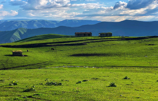
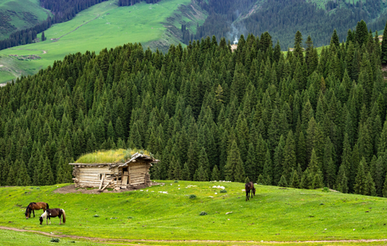
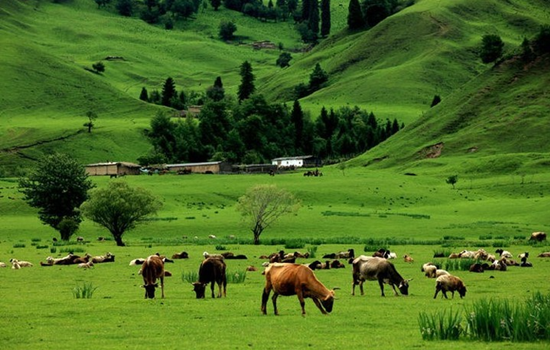
Qiongkushtai is a pastoral village with more than 300 households and more than 1,700 people,and the village residents are mainly Kazakh. The village is surrounded by mountains,the houses are built by water,and the Courdai River flows all the year round. The buildings of the village are mostly round wooden structure,which is a well-preserved wooden architectural complex in the Ili River Valley. It has high historical and cultural value and is gradually attracting more tourists to travel for vacation.
Itinerary
On the way to Qiongkushtai,the alpine meadow and grassland under the blue sky and white clouds are all the beauty of the computer desktop.
You can stroll around the village,ride a horse or go to the Wusun Ancient Road,even in a quiet stay.
kindly reminder:
1. Qiongkushtai Folk Village was originally a fixed residence of Kazakh ethnic compatriots. The wooden house and homestay here are similar to Hemu Village,and there is a big gap between the living environment and the city;
2. If you need to ride along the Wusun Ancient Road,please choose the regular horse team in the village.
Day 5 Qiongkushitai-Tekes (about 100KM)
Today's attractions:
Karar jun
"Karajun" is a Kazakh language that means "the wilderness on the ridge". Kaljun mountain is a east-west rolling mountain,it is flanked by the gully comb mountain,ups and downs,the growth of dense primitive spruce forest. Between 2000 and 3600 meters above sea level,it is an alpine meadow grassland,which is about 25 kilometers wide from north to south and more than 40 kilometers long from east to west,with a total area of more than 1000 square kilometers. It is the most beautiful area of Tianshan grassland,completely retaining the original and pure natural appearance,grassland and forest blend,snow peaks and valley reflect,the scenery is very spectacular,showing the original beauty of snow ridge spruce.
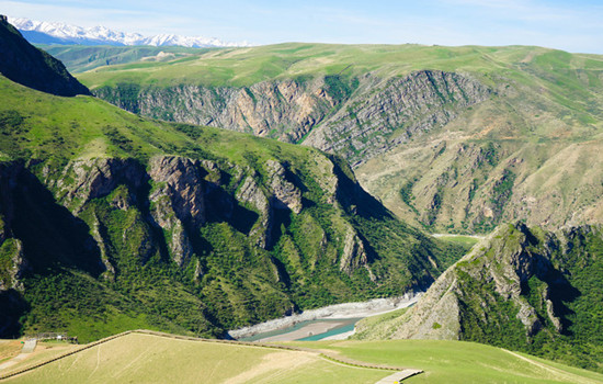
Khoksu Grand Canyon
The Kuoksu River twists and turns,forming the nine curves of over 5,600 meters long from north to south and more than 2,000 meters wide from east to west. Herdsmen's yurts are dotted with them,gorge scenery,waterscape,mountain scenery,tree scenery and other natural landscape,full of fun.
Itinerary
Kuksu Grand Canyon scenic area includes nine curves 18 Bay,Kuksu Grand Canyon and Crocodile Bay,and finally from the Kurdai River cableway into the Kaljun Grassland scenic area.
Transfer to the regional bus and start to visit the Karajun scenic area. The flower platform is an excellent place to enjoy the beautiful scenery of the grassland. After getting off the bus,climb uphill along the plank road. Although it is a little laborious,you can see the snow mountains,forests,flowers and grasslands here,and you can also take photos with the lamb. Falcon platform: a traditional hawk place for local people. After getting off the bus,it is recommended to go about 1 km along the plank road (also on horseback),overlooking the "three-level level plane" and forest canyon.
Free dinner after staying at the Tekes County Town Hotel. You can also go out of the scenic spot in advance to the exit street and Bagua Park in Tex County,and feel the many marks of the I Ching culture in this characteristic county.
kindly reminder:
1. the interval car circulation system in the scenic area,so please listen to the master explain whether to take everything to get off the bus;
2. each stop has a canteen,only in the ropeway station below a restaurant can eat on the way.
Day 6 Tekes-Xinyuan (about 160KM)
Today's attraction: Kurdistonin
Kuronin is the Kazakh language. The grassland scenic spots in Yili are located in the east-west valley,but Kuronin is in a north-south mountain valley,about 14 kilometers long,about 1 km widest,the average elevation of the valley is 1500 meters. The special trend makes Kurdistan warm in winter and cool in summer,and the climate is pleasant in the four seasons,so it has both the charming and beautiful scenery of the south of the Yangtze River and the broad and rugged grassland scenery,attracting more and more tourists at home and abroad. Her stunning appearance and extraordinary natural landscape is breathtaking,make people infinite yearning.
Itinerary
There are also many regional car stops in Kurdisting scenic area,which can determine the length of parking in each scenic spot according to the actual situation. Choose the dining place in real time in the scenic area,and you can also bring your own dry food to enter the scenic area.
kindly reminder:
1. Weather changes quickly,pay attention to weather changes at any time and decide the stay time;
2. more winding mountain road,please prepare carsickness medicine in advance.
Day 7 New Source-Nalati (about 100KM)
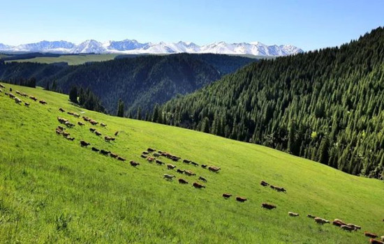
Today's attraction: Naraty
Nalati tourist scenic spot integrates grassland,valley and forest,with high vegetation coverage rate and rich wildlife resources. Because of its unique natural ecological landscape and cultural landscape,it is known as "Tianshan Green Island","green home" and "colorful grassland". The main scenic spots are Tianjie Platform,nomadic family,Tusani (meaning "beautiful valley" in Kazakh),Sendai,Wall Tower observation platform,Snow Lotus Valley and so on.
Itinerary
Enter the Nalati grassland scenic area,look for the rich scenery of the beekeeping keeper. You can overlook the beauty of the whole valley grassland,and also go to the snow lotus valley and snow mountain close contact,feel the summer cool summer.
kindly reminder:
1. Nalati Air Grassland is located in the mountainous area,please always ready to add clothes.
Day 8 Naraty-Yili (about 90KM)
Today's attractions: Xibe Folk customs Garden
The gates and walls of the Sibe Folk customs Garden are built after the ancient walls,with the relief patterns of Xibo hunters shooting arrows and Sibe dancing. Entering the gate,you will see the sculpture of-Tubert,a hero revered by the Sibe people.
In the museum on the left of the Xibe Folk Customs Garden,a large number of traditional utensils,books and historical documents from the Xibe people were collected from the west and the survival and development of the nation.
The teahouse is a unique style building in the Xiber Folk customs garden. The antique design of the inner hall is quite innovative,but the most striking is the Xibe folk song and dance team,spontaneously established by six or seven rural women. In order to inherit and carry forward the Xibe folk songs and dances,they invited the retired old actor Ge Fengxiao from the Qapqal county art troupe to guide them. In the absence of clothing and money,these women found their own ways to overcome it. Now,whenever visitors enter the teahouse,they perform songs and dances with the Xibe style.
Itinerary
After breakfast,return to Yili city,and then go to Qapqal Xibe Autonomous County,which is a folk customs garden that gathers and displays the history,culture and folk customs of the Xibe people. Xibe Folk Style Garden presents you the unique charm of Xibe folk style which is "unique in the world and unique". In the folk customs garden,there is also a painting wall reflecting the industrious and brave labor,celebration and hunting scenes of the Sibe people. The characters are distinct,and the scenes are grand and infectious.
kindly reminder:
1. It is possible to have different air ticket times to Kuqa in different seasons. The flight time could be the same night,or maybe the next morning.
Day 9 Yili-Kuqa (aircraft)
Today's attractions:
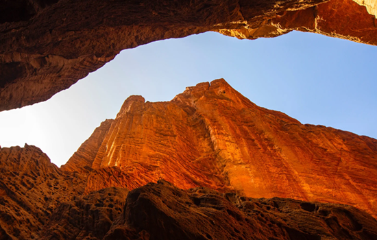
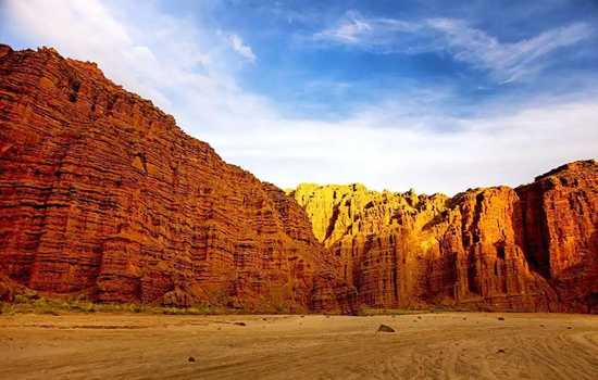
Tianshan Mountain mysterious Grand Canyon
The mysterious Grand Canyon is in the landscape of Kizilla,one of the nine film and television bases in China. The huge red mountain group was formed in the Mesozoic Cretaceous period 140 million years ago,after millions of years of wind and rain erosion,flood erosion,forming a crisscross,orderly ridge and groove,far look picturesque,like "Potala Palace",fairy day Qiongge; close look like people like things,like a dream,lifelike,charming. It is uncanny workmanship,the wonder of heaven into the lament.
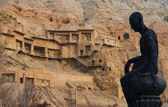
Kizil Thousand Buddha Caves
Back to mingwu Tap Mountain,facing the Muzat River in the south,during which the Weigan River winds through,about 69 kilometers from Kuqa county in the east,belongs to the territory of the ancient Qiuci State. It was dug in about the 3rd century and gradually stopped building in the 8th and 9th centuries. As of 2019,there are 236 grottoes with more than 10,000 square meters of murals.
There are two kinds of caves in Kizil Thousand Buddha Cave: one is a place for monks to live and produce,mostly with living kang and simple living facilities; the other is the Buddhist temple,which is a place for Buddhists to worship and lecture. The temple is divided into the giant Buddha grottoes with tall grottoes,open grottoes,the main wall of the Buddha,and the central columns,and some of them are the square grottoes with more regular grottoes. Different shapes of caves have different uses.
Itinerary
Visit the Tianshan mysterious Grand Canyon,where the valley side of the rugged peaks,competing to rise; overlapping peaks,split the sky,cliff rocks,majestic magic. The scenic area depends on hiking and must go back,according to their own actual situation,pay attention to control the round-trip time.
As one of the four grottoes in China,Kizil Cave is the most intact grottoes with the largest open area in Xinjiang.
On the way back to Kuqa,you can find the best shooting point in the salt ditch,not the scenic spot is more spectacular than this scenic spot!
kindly reminder:
1.Tianshan mysterious Grand Canyon scenic area should pay attention to the safety of the foot,are sand road,wear convenient walking shoes are more suitable; some places limited traffic conditions need to queue up through,walk do not see the scene,see the scene do not walk;
2.If the Kuqa Grand Canyon National Geopark is prone to flood in rainy days,please follow the management of the scenic spot and refund the tickets when you cannot visit;
3. Salt ditch section parking photos must stop in a safe area,cross the road should be careful;
4.If you need to detour to the garage during the prohibited period of the single library highway,the scenic spots on that day can be postponed to the next day,or the individual scenic spots can be cancelled through friendly negotiation.
Day 10 Kuqa day tour
Today's attractions:
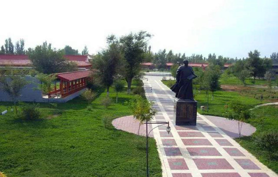
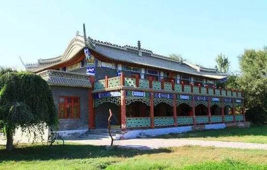
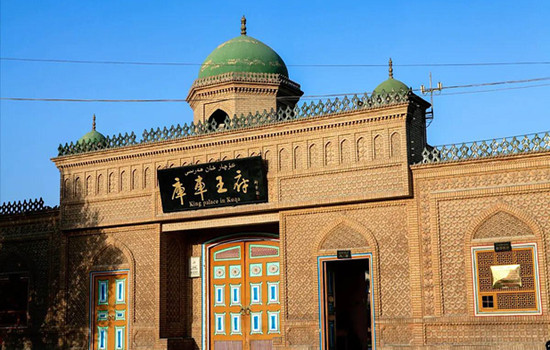
Library car king's house
There are Qiuci Museum,Kuqa Palace cultural relics hall,Kuqa folk custom exhibition hall,the last "Kuqa king" official Tai Qing Dynasty city wall and so on. Visitors can learn about the 190 years of the hereditary "Kuqa King" through the exhibition of cultural relics,family history and special diet.
Kuqa Palace is a large area,about two or three hundred meters,there are many buildings inside,most of the buildings are Uyghur style,colorful interior,you can take photos everywhere,there are gardens and green space in the courtyard,the environment is very good. The palace visit is divided into three places: Qiuci cultural exhibition area,Wangfu visit area and the old city wall. After entering,you can walk to visit,generally about 2 hours is appropriate. The Qiuci cultural exhibition area shows the cultural customs of Qiuci country in the history of Xinjiang. There are many text and pictures,the precious cultural relics of Qiuci Buddhism,and the production tools,coins and folk handicraft relics of the ancient country.
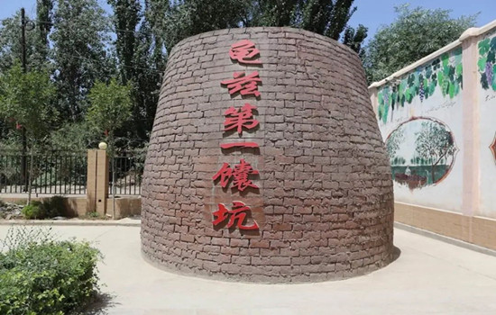
Kuche big naan city
It is not only a concentration of naan production and sales,but also a 3A level folk customs tourist area. As an intangible cultural heritage of the autonomous region,Kuqa Da Nang enjoys a national reputation for its large and thin,crisp and fragrant characteristics. Kuqa Nang City covers an area of 20,000 square meters,divided into three parts: affordable residential areas and commercial areas and naan culture exhibition area,among which the commercial district has naan culture exhibition hall,folk characteristic catering area,naan production workshop,naan exhibition and sales hall,etc. There are special food,big naan culture exhibition hall,mass culture stage,is the Kuqa County strive to build the propaganda and cultural base,characteristic catering base,employment and entrepreneurship base.
Itinerary
The old city wall of Kuqa Palace is an ancient building in the palace,so you can have a simple look. In the scenic area,there is also the original display area of the former Wangfu,and there are displayed items used by the Kuqa king of all dynasties. Through wax figures,the life scene of the former Wangfu family is restored,and you can visit one by one to feel the living atmosphere of the former Kuqa king.
Kuqa Da Nang City is an ancient city building selling big nang. There is a large nang at the gate of the city to take photos. The wall inside and outside the wall and the ceiling are all decorated with big nang,which is instantly wrapped by the rich Xinjiang nang culture. On the first floor is the music square. Many local aunts sing and dance with them,which is also an immersive opportunity to experience the local customs. The second floor is the place where Nang is sold. The factory workshop is transparent. You can see the whole process from kneading flour to baking Nang. The old tea house is also on the second floor.
kindly reminder:
1. If you do not follow the collective activities on that day,you should explain to the accompanying driver in advance;
2. In case of a detour to the garage the day before,the scenic spots on the same day can be arranged according to the actual situation.
Day 11 Kuqa-Alar (about 260KM)
Today's attractions:
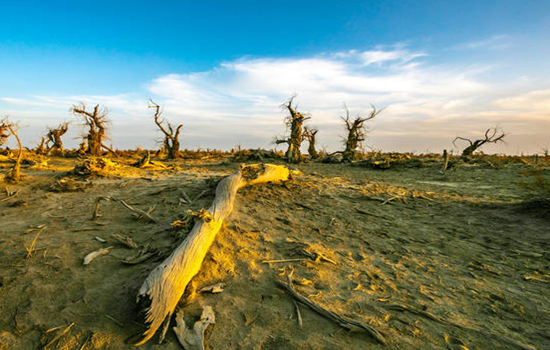
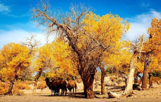
Shaya devil forest
The devil's forest is on the edge of the Taklimakan Desert,where the soil is soft sand,walking through the woods,sometimes the whole foot into the sand. Here,you will have a strong sense of thirst,the color is also a single earth gray,only to look carefully,to see a red willow or two scattered on some raised sandbags,showing a little green.
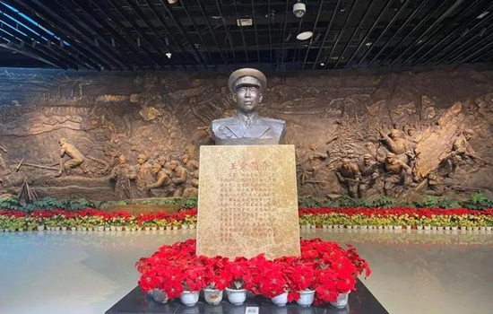
Military reclamation museum
Its content to the hero of the red army and the eighth route army 12 O brigade revolution history,the construction of the Xinjiang production and construction corps history as the main line,through the physical,pictures,sound and photoelectric multimedia,relief,sculpture scene,detailed and comprehensive show the troops from the red army period,to bay production,fighting,to the liberation of the northwest,troops in the tianshan north and south field,forest land production,driven by bay spirit,promote each enterprise vigorous development,four civilization construction achievements,agricultural modernization leading the national agricultural development,etc.
This museum is one of the most worthwhile museums in Xinjiang.
Itinerary
There are many dead poplar trees in the Shaya Devil Forest scenic area,which is the product of the diversion of the Tarim River riverbed,and few tourists in the small scenic area can play slowly.
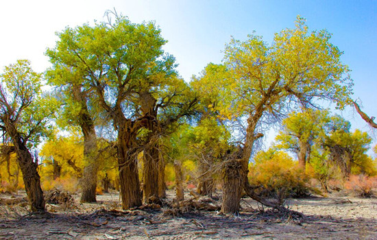
On the way to Alar,you will pass a large area of Populus euphratica forest,standing at both ends of the Tarim River bridge can take pictures of the beautiful Populus euphratica.
The Military Reclamation Museum is also the 359 Brigade Reclamation Cultural Memorial Hall,with a construction area of 11,000 square meters. The museum shows the legendary entrepreneurial history and struggle history of the 359 Brigade,and introduces the process of the corps army reclamation people to support the building and reproduce the civilization. It is a monument forged by several generations of army reclamation people with blood and sweat,and is a famous red tourist attraction. What I see here is not only a museum,but also a history book of the development of the Xinjiang Production and Construction Corps.
kindly reminder:
1.There are many mosquitoes in the Shaya devil forest,please prepare mosquito repellent water in advance. Ultraviolet light is strong,pay attention to wind protection,sunscreen and water supplement;
2.Devil forest scenic area dry less rain,strictly fireworks;
3. Today the journey is far,can take some snacks,fruits,etc.,with enough water,not good to buy along the way;
4. If the Army Reclamation Museum closes on Monday,the trip will be cancelled.
Day 12 Alar-Khotan (about 420KM)
Today's attractions:
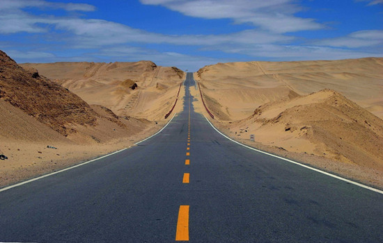
Desert road
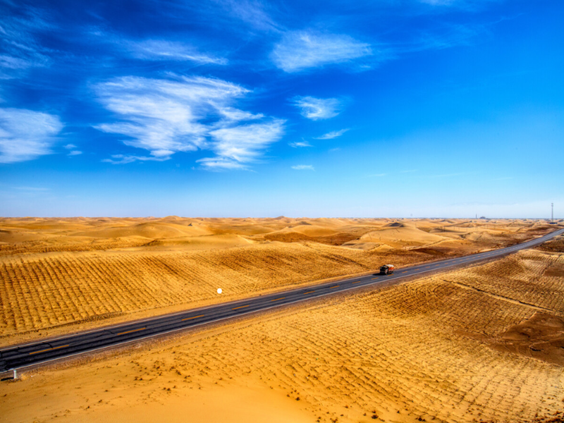
The Tarim Desert Highway is located in the center of the Tarim Basin in southern Xinjiang. It is the largest desert in China and the second largest mobile desert in the world,second only to the Sahara Desert. It is known as the world's first "green corridor of desert".
The road is like a long black dragon cruising in the vast expanse of sand sea,rolling along the low ground of the sand dunes,becoming a unique landscape in the Taklimakan Desert.
Yurunkax River
Starting from the large and large Kunlun mountains and entering the Tarim Mountains,it joins and joins the Karrakash River in the west. The river is 325 kilometers long,has many tributaries,and has a basin area of 14,500 square kilometers. The river is rich in white jade,green jade and ink jade,since ancient times is the main river of Khotan jade. Also known as white Jade River,it is a river in Hotan region of Xinjiang,China.
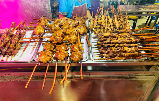
Khotan night market
Khotan Night Market is located in Renmin West Road,covering an area of 4600 square meters,with a narrow and closed greenhouse space,a total length of 272 meters,very neatly placed according to the two sides,a total of 260 stalls,it is said that there are more than 100 varieties of food here. Here as long as you want to eat things can find,all kinds of flavors,everything,the variety is amazing.
Itinerary
Along the desert road from Alar to Hotan to the south,through the sand dunes,poplar forests,dry riverbed,desert villages,is a different scenery of southern Xinjiang.
Arrive at the famous Yulong Kashgar River,also known as the White Jade River,see if there is any luck to pick up the heirloom Khotan sheep et white jade!
After staying in the hotel,you can have a rest and go to the Khotan night Market according to the actual time to taste the local specialties.
kindly reminder:
1.Yulong Kashgar River tourists can experience the happiness of jade pickers,walking on the cobblestone riverbed must pay attention to safety;
2. Khotan night Market has many delicacies,so you can choose the food suitable for your own taste.
Day 13 Khotan-Shache (about 300KM)
Today's attractions:
The ancient city of Yotkan
The culture of ancient Yutian is the soul of the project. Based on the historical records of the ancient state of Khotan,the builders have compiled more than 700,000 words. The architectural style has basically restored the square city,the white Ayawang dwellings,the Missouri Fort and the Qifeng Pagoda recorded in the historical books.
The background and historical relics,the variety of traditional delicacies,handicrafts,bazaar and traditional festivals,and the combination of historical facts and story interpretation,tell the charm of the ancient city of thousands of years.
Shache Intangible Cultural Heritage Park
Also known as the Khan Palace,with blue as the keynote,thick Central Asian customs,as if through the prosperity of thousands of years ago. There are also several small exhibition halls,introducing the traditional customs of Tajik,Kirgiz and Uygur,as well as twelve Mukam,Adeles and others.....
Itinerary
During the day,the theme of "Ten Hundred plays",showing the solemn ceremony of the old city,and the folk customs on the ancient Silk Road.
There are twelve Mukam performances at 12 pm and 16:30 PM every day. Twelve Mukam is a traditional Uyghur musical performance,and the performers will be invited to dance together.
kindly reminder:
1. Jotean Ancient City is a newly developed tourist attraction in Hotan area,which is very different from other ancient cities in appearance and color. Take photos and punch in to prepare brightly colored clothes;
2. There is a fixed time for davazi performance in Shar Intangible Cultural Heritage Park. If there is no plan in advance,you may miss the performance.
Day 14 Shache-Wuqia (about 300KM)
Today's attractions:
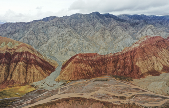
Colorful mountain
There are two colorful mountains here,one is also known as the ancient sea shipwreck,which is said to be the human legend of the "Noah's Ark". Another is like a monk hat,according to legend is that when the Tang monk to the West through the Pamir Plateau,because of the high altitude,wind and sand,the climate changes,the Tang monk's hat scraped down here,into a colorful mountain. According to expert research: this mountain formed in the Tertiary,is a red sandstone and gypsum layer superposition of the Yadan landform.
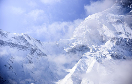
The intersection of the Tianshan Mountains and the Kunlun Mountains
The Tianshan Mountains and Kunlun Mountains meet on the Pamir Plateau,and this intersection has obvious geographical characteristics. Tianshan Mountains are camel here,east-west,separating junggar and Tarim basins,is one of the tall mountain system in Asia,with an average elevation of 4000 meters; Kunlun Mountains are dark here,starting from the Pamir Plateau in the west,with an average elevation of 5500 meters. Here,you can look at the two mountains,enjoy the unique scenery of the world-class mountains in both places,feel the "Wanshan Museum Park",and experience the vigorous mountain-making movement,which is a world-class natural wonder.
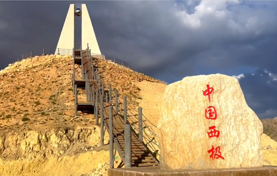
West pole village
Xiji Village,also known as Sihanana Village,is the westernmost village in China's geographical map of China. It is a Kirgiz village that makes a living by grazing. It is known as the western pole of China and the "last ray of sunshine" of the motherland. In terms of longitude,it is the westernmost end of China's territory,the last place to welcome the sunrise and the last place to send away the sunset,adjacent to the Oshi Prefecture of Kyrgyzstan.
The western pole Tower is located in the village of Smokhana,which is the tourist punch point of the western pole of the motherland.
Itinerary
Arriving at the Colorful Mountain in Wuqia County,the ancient sea site shell Mountain,watching the Danxia landform along the way,you can see everywhere the exposed rocks on the mountain are covered with shells,and the outline and lines of shells are clearly recognizable. In summer,there are water and green plants,along the way,there are flocks of cattle and sheep and camels walking leisurely,the scene of southern Xinjiang road.
Landmarks at the intersection of the Tianshan Mountains and the Kunlun Mountains,where the Tianshan Mountains and the Kunlun Mountains meet here on the Pamir Plateau. The Tianshan Mountains are camel color,and the Kunlun Mountains are dark color. Here,you can look at the two mountains,enjoy the unique features of the two mountains,and feel the "Wanshan Museum Park".
At Xiji Village,Sikhana village in Jigen Township is the last place to see the sunrise and the latest place to leave the sunset. It is only 2 kilometers away from the China-Kyrgyzstan border,with a nearly four-hour time difference from the southeast coast. As the sun sets down,the whole village is shrouded in the last sunset of the motherland.
kindly reminder:
1. The temperature difference between morning and evening is recommended to carry a coat and hat to prevent sun protection; it is recommended to wear bright clothes,and the plateau scenery is more prominent and released;
2. the border checkpoint needs to check the ID card and border pass,please cooperate with the inspection,the checkpoint is not allowed to take photos,please understand.
Day 15 Wuqia-Taxkorgan (about 300KM)
Today's attractions:
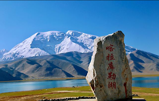
White sand lake
Baisha Lake is a scenic spot that has gradually begun to enter people's sight in recent years. Baisha lake is scattered with the white sand,and the distance around the lake is the snow-capped mountains. The whole Baisha Lake is surrounded by the surrounding snow mountains,around the tall snow mountains like a kind "mother" guarding this plateau lake,so that it will not be disturbed by the outside world.
Kharakule Lake
To the east of the lake stands the "father of the glacier",the peak,to the west; the south of the lake is the grassland,a summer comes,the clear grass,the lake,green grass,a white felt dotted,and the reflection of the lake,as in the ancient poem "wind grass low see cattle and sheep". Pastoral songs on the grassland,the wild duck on the lake,this scene,like a dream,no wonder even the 10th century BC Zhou King Mu so far also sighed,feeling.
Itinerary
On the shore of Baisha Lake is a large area of high hills and rolling mountains. High mountain is sand mountain,sand mountain is silver white,silver white fine sand white soft,like white silk. More than 10 hills composed of the Baisha Mountain winding more than 10 kilometers. The snow light in the distance reflects the Baisha Lake,and the grass planting by the Baisha Lake reflects the Baisha Mountain.
Karakule Lake is rich in water and grass,with thousands of waterbirds and wild ducks swimming on the water surface,and sometimes the opposite swans playing in the water. Besides the grass beside the lake,there is no living creature in the lake,especially because the lake constantly changes various colors throughout the day,which is confusing.
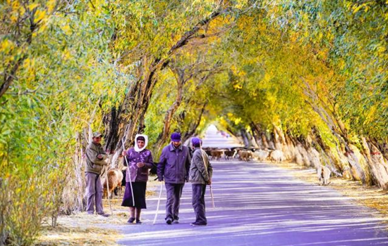
On the way to Tacheng County,you will pass by the Tahman Wetland Park. The tall willows on both sides of the road interweave into arches,leading forward to the towering snow-capped mountains and blue sky in the distance. Driving through it,as if through the fantasy space tunnel,this inexplicable shuttle sense,only once to experience.
kindly reminder:
1. This trip will pass by Daban at the highest altitude of 4000 meters. If friends who have had high anti-experience start to drink Rhodiola or other preventive drugs 15 days in advance,they can also prepare oxygen bags / bottles in advance. Plateau area,please pay attention to the body,reasonable diet,avoid strenuous exercise,beware of altitude sickness;
2. Keep slow,calm,avoid fast running or other sports,and try not to drink in Tacheng. Ta County is located in the plateau,tourism reception facilities are backward,the hotel standard is low,cold prevention is not recommended to take a bath,please understand more inclusive; if the bath do not close the bathroom door,if any discomfort,please seek medical advice in time;
3. today's driving speed limit,the speed will be very slow,please understand more;
4. No photos and videos can be taken at the checkpoints along the way;
5. Before departure in the morning,please take out the thick clothes and put them around you. The temperature drops after reaching the plateau,and please be ready to add clothes at any time.
Day 16 one day of trip in Taxkorgan(about 150KM)
Today's attractions:
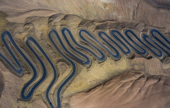
Panlong ancient road
The road,named Wacha Highway,is one of the two roads leading to Wacha Township,Ta County. Although the road is difficult,it can greatly shorten the distance and the time of getting in and out of the county. Because this road is like a dragon dragon lying on the mountain,so named "Panlong Ancient Road".
The most challenging is the small pan dragon with dense curves,just like a hair card worn on the girl's head,winding,neat,as the saying goes,"today through all the detours of life,from now on life is smooth".
Bandier Lake
In different weather,not after time,different seasons and different light,the lake will produce different colors,sometimes may be dark blue,sometimes is light blue or Tiffany color,color diversity more than white sand lake and kara library lake,better luck,encounter no wind,the mountain on both sides of the lake will completely reflected on the lake. Very beautiful. Bandier Lake was originally a river,built as a reservoir for water storage. The lake is glacial melt water because the special minerals are blue. It is blue blue in summer and dark blue in winter.
Pamir tourist area
The Pamir tourist area includes Stone City and Golden Grass Beach.
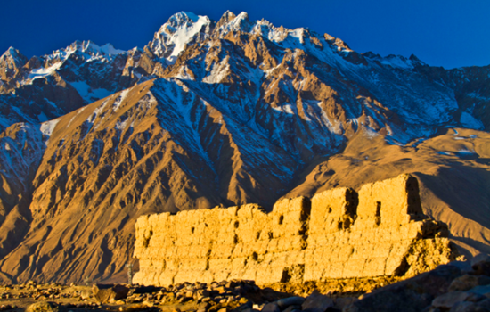
The stone city castle is built on a high hill,and the situation is extremely steep. Outside the city,there are multi-storey or broken or continuous city walls,with overlapping stone hills between the walls and piles of stones,forming a unique stone city scenery. In the Han Dynasty,it was the king city of Puli State,one of the 36 states in the Western Regions. After the Tang Dynasty unified the Western Regions,there was a green here. At the beginning of the Yuan Dynasty,the city was greatly expanded,and the old stone city was changed into a new face. In the 28th year of Guangxu,the Qing Dynasty established the Bo Hall and repaired and supplemented the old castle.
Jincao Beach is on the Alar grassland below the Stone City. The construction contents include the Silk Road Castle Square,the Stone City cultural wall,performing arts square,landscape column,Naxi viewing platform,the ancient city sunset stand,the grandstand,Yongquan stand,the water platform,wooden plank road,50 meters of breathtaking suspension bridge,sightseeing water wheel and other scenery.
Itinerary
Panlong ancient also known as tile just highway,total length of more than 70 kilometers,people here is divided into big panlong and panlong,including small panlong about 30 kilometers long,from 3000 meters to 4100 meters,the drop of more than 1100 meters,so the 30 kilometers of mountain road appeared 639 corners,and basic is more than 180 degrees of a S bend,the road is a test for the driver. Someone joked: having opened this road,all the other roads are floating clouds.
Bandier Lake is a free scenic spot on the road back to Ta County. Quiet and beautiful Bandier blue Lake,like a blue clear plateau pearl,walking along the road beside the river,you will see a bridge on the lake,and the scenery here is the most beautiful.Although the stone city is only ruins,but there are snow peaks,grass beach,rivers,and strong Tajik ethnic customs,quite rough and unrestrained beauty. After visiting the stone city to the opposite side of the road is the golden grass beach wetland,walk along the plank road while playing for about an hour to the interval bus boarding point,to the scenic area near the entrance of the colorful cloud people.
kindly reminder:
1. At noon,there are some Tajik villages near Panlong Ancient Road. If you are not used to eating,you can bring some snacks or convenient food,and return to Ta County for dinner,so that you can taste the delicious food well;
2.the average elevation of Taxkorgan county is 3200 meters,pay attention to the plateau action is still slow,less shops into the scenic area,so it is best to take mineral water or water cups,do not take unnecessary things;
3.the sun goes down the temperature will be low,so when entering the scenic area,calculate the time,ready to add or subtract clothes at any time.
Day 17 Taxkorgan-Kashgar (about 300KM)
Today's attractions: Oyetag Glacier Park
Otak Glacier Park is an ancient Turkic word meaning "a depression among the mountains". With an annual average temperature of 7.8°C,surrounded by mountains on three sides,steep snow-capped peaks,vertical glaciers and dense trees,it is praised as "the first natural ecological landscape in the Western Regions" by geological experts. The most interesting is one of the world's most rare low latitude modern glaciers in the-Its Klaze Glacier,which is only 2804 meters above sea level,is the lowest altitude glacier in China. In summer,avalanches often occur on the snow-capped mountains above the glacier,witnessing a stunning natural spectacle from the viewing platform.
Itinerary
Oytag Glacier Park integrates snow mountains,glaciers,waterfalls,rivers,avalanches and grasslands,plus the herds of cattle and sheep on the hillside and the round yurt of Kirgiz herdsmen,filling this great and holy virgin land with natural beauty,without a trace of artificial carving,everything is pure and natural.
After returning to the city of Kashgar,you can visit the old city of Kashgar to feel the unique charm of the most famous ancient city in southern Xinjiang. See the kaesong ceremony,ethnic song and dance,eat steamed stuffed bun,eat pure handmade ice cream,go to the century-old teahouse tea... or sitting in the sightseeing car,shuttle in the crisscross roadway,leisurely,enjoy the jade,bronze,flower hat,ethnic instrument shop,the unique scenery line must make you busy. After that,you can taste the Uyghur characteristic tea along the century-old street to the century-old teahouse. You can also visit the Id kah Mosque by yourself and feel the rich ethnic atmosphere of the most famous mosque in southern Xinjiang.
kindly reminder:
1. Oyetag Glacier Park needs to hike to the viewing platform,please do anything and pay attention to safety!
2. You need to take off your shoes to visit it. If you are clean or do not want to take off your shoes,please prepare disposable shoe covers in advance.
Day 18 One day trip to Kashgar
Today's attractions:
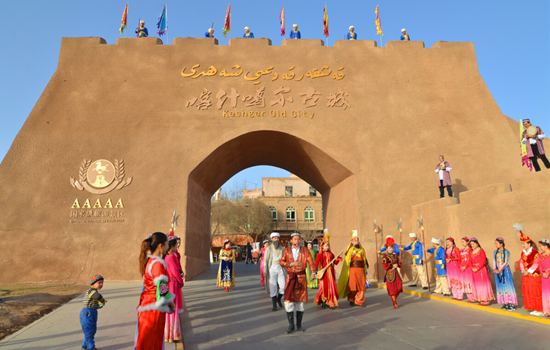
Kashgar ancient city
Strange natural scenery,rich ethnic customs,brilliant historical district road roadway,a little wider can walk donkey cart,narrow two people side by side; the street elderly more than 600 meters,short 50 meters to the end. Streets and lanes east turn west fold,south bend north wrong,twists and turns,seemingly all the road,but then see a lane,just like All Men Are Brothers Zhujiazhuang Pantuo Road. On both sides of the roadway is a household Uyghur house. Residential houses are very characteristic. Generally,people build two to three floors of civil structure on a limited plane,and some extend down and build basements. Living room and bedroom are connected by wooden escalators and stairs. Every house has a drying stand on a flat roof. Each household has a small courtyard for growing flowers or placing bonsai. Bonsai,flowers and building pillars,wood carvings,eaves on the eaves of flowers complement each other,strewn at random,quiet and fresh. Sometimes at the junction of the two alleys,there will encounter a small building across the street,like a porch,so that the alley adds a bit of simplicity and depth. Walking up narrower and narrower alleys,walking through higher and taller houses,I came to a Uighur family in Ziliqi Lane. According to the introduction,this house is built in the top of the old block. After entering the door,the foot steps on the wooden ladder,step up,climb to the roof ridge,the eyes suddenly open,really have "see all the houses short" feeling. Even the distant tall buildings,as if only at the feet.
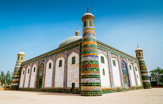
Apak Hoja Mazzar
The scenic spot tells the story of hometown,former residence and the fragrant princess from birth to death,from Kashgar to Beijing,from the fragrant princess to thousands of pet."Happy Apak Hoja Mazzar,love card,here,will let you deeply understand the love story of fragrant concubine. Experience Kashgar's characteristic customs and folk culture from zero distance.
The scenic area has tourist service center,concubine stone,concubine welcome ceremony,western folk culture center,former residence of concubine,
Folk wedding,ancient water mill,love tree,fragrant concubine relief wall,treasure,building,incense pavilion,mirror pool,100 orchard,oil press,Kashgar old bazaar,nang shop,fragrant concubine gallery,intangible cultural heritage exhibition area,TikTok beauty shooting base,etc.
Itinerary
You can visit the old city of Kashgar to feel the unique charm of the most famous ancient city in southern Xinjiang. See the kaesong ceremony,ethnic song and dance,eat steamed stuffed bun,eat pure handmade ice cream,go to the century-old teahouse tea... or sitting in the sightseeing car,shuttle in the crisscross roadway,leisurely,enjoy the jade,bronze,flower hat,ethnic instrument shop,the unique scenery line must make you busy.
Those who are interested in visiting the mosque can go by themselves,and then they can follow the century-old street near the mosque into the old city Xicheng district of Kashgar,and go to the century-old teahouse,Rainbow Lane,cloth Bag Lane and other web celebrity punch points to take photos.
The garden is a colorful picture; the garden is a touching ballad; the garden is a passionate poem; the garden is a confusing legend; the garden with its characteristic spectacle beauty,folk dance,love legend,open arms to welcome the world.
kindly reminder:
Today is the rest day. If you do not follow the group activities on that day,you should explain to the accompanying driver to arrange it by yourself in advance.
Day 19 Kashgar-Bachu (about 280KM)
Today's attractions:,Bachu Red Bay
The Red Bay's natural ecological landscape is unique. Here are both the graceful and beautiful Jiangnan water towns,and the vast desert Gobi. This blue water area of the Yarqiang River basin,with lush reeds and birds flying,is a dazzling pearl on the desert oasis. Kashgar River wetland is rich in vegetation,herds of cattle and sheep,winding plank road,gurgling water,emitting a tranquil and fresh pastoral atmosphere. The 3.16 million mu of poplar forest is the largest natural wild poplar forest in the world,its uncanny form,majestic upward momentum,indomitable will,indomitable spirit,all vividly deduce the tenacious natural life,the magnificent desert scenery.
Itinerary
Bachu Red Bay is a holy place to enjoy the natural scenery and choose leisure and vacation,a window to pursue historical relics and explore the Silk Road culture,and a paradise to appreciate ethnic customs and taste special food.
kindly reminder:
1.There are few restaurants and shops in Buhong Bay scenic area,please prepare water and snacks before entering the scenic area;
2. Fireworks are strictly prohibited in the poplar forest;
3. If there are friends who have not finished the scenic spots in Kashgar,they can continue to play in the morning before going to Bachu.
Day 20 Bachu-Aksu (about 240KM)
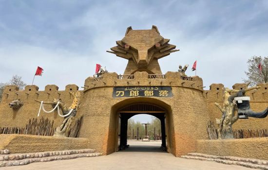
Today's attractions: The Daolang tribe
The Daolang people,the original residents around the Tarim Basin in Xinjiang Province,have been living in the isolated desert oasis and maintaining their unique folk customs. There is a folk custom exhibition hall,which you can visit and understand the story of Daolang nationality. In addition,there are vineyards,fig garden,fishing area,self-service barbecue area,farm,etc.,you can come to entertainment,taste daolang food experience rich folk customs. In the east of the scenic area,the scenery is mainly the poplar forest. The large area of primitive poplar forest here can come to watch the most tenacious tree species in the desert and shoot large pictures. On the south side of the east,there is a primitive village of Daolang people,which reproduces many scenes of daolang ethnic life,including houses,wooden carts,labor tools,etc.,which you can go to visit.
Itinerary
The daolang tribal scenic area has a large area,nearly 1 km long and wide. After entering the scenic area,you can walk to play,about 3-4 hours is appropriate. The west side of the scenic area is close to the river,where there are a hundred orchards planted here. The environment is fresh and beautiful,which is very unique in Xinjiang,where the Gobi is everywhere. A sand sculpture park and a statue are also built on the beach,which are suitable for taking photos. In the middle of the river,there is a water recreation area and an open-air ecological swimming pool,where you can enjoy the water fun. The central part of the scenic area is mainly leisure and display of daolang folk culture.
kindly reminder:
If you arrive in Aksu City early on the same day,you can play in the downtown Duolang Park or Aksu Old Street.
Day 21 Aksu-Luntai ( about 40 KM)
Today's attractions:
Wensugu Grand Canyon
Wensu Grand Canyon is located in Bozidun Kirgiz Ethnic Township,the southern foot of the middle section of Tianshan Mountains in Wensu County. The Grand Canyon is 80 kilometers north of the east of Wensu County and 26 kilometers away from the national road 314 line,with a total area of 200 square kilometers. It used to be the only way to the ancient post road of the North and South Tianshan Mountains. It was called "Kuduruk Grand Canyon",which means "breathtaking and mysterious" in Uyghur.
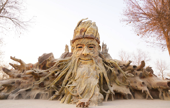
Tianshan Shenmu Garden
In the Shenmu garden,the blow of wind and sand,thunder and lightning,as well as the years of hone,so that hits the giant trees into a strange tree,but also gave them a kind of spirituality. Tourists come here not only to see the "tree",but also to see a perception of the world. The park is 1,700 meters above sea level,covering an area of nearly 680 mu,with hundreds of ancient trees more than 1,000 years old,including willow,poplar,wild apricot,walnut,mulberry and other tree species.
Itinerary
In wensu Grand Canyon take the car to the spring of life,can go from the spring of life to no. 3 valley,ask the valley,about an hour,and then go to the queue,about 3 minutes to the next station,get off the photo time to adjust,take photos in the car directly to the gate.
Tianshan Shenmu Garden enjoys a high reputation for its beautiful and strange natural scenery,rich and colorful plant resources and honest ethnic minority culture. This "Gobi Pearl" is located 60 kilometers northwest of Wensu county,which is a holy land for the integration of nature and culture. In the garden,the water gurgling,dozens of tombs still exist,all kinds of trees and flowers are scattered at random,showing the magical beauty of nature.
kindly reminder:
There are more hiking places in Wenshu Grand Canyon than other scenic spots. Please prepare a pair of comfortable and light travel shoes in advance.

Day 22 Luntai--Korla (about 280KM)
Today's scenic spot: Luntai Populus euphratica forest Park
Luntai euphratica Forest Park is located in the core part of Tarim euphratica reserve,crossing the middle reaches of Tarim River at the junction of Luntai and Weili County. The poplar trees here are thick,the diameter of the tree is generally 60-80 cm,thick up to 1 meter,and there are often two or three poplar trees growing together,its diameter is about 1.6 meters,the height of the tree is generally 5-8 meters,the height can be more than 10 meters. The spacing of poplar trees is generally about 20 meters,and the distance of clustered trees is only 3~4 meters.
The sightseeing area is 17 km with 126 ancient poplar forest roads for visitors to enjoy the appearance of poplar; the core also has a 13 km long circular railway connecting several large forest lakes,tourists can enjoy the desert scenery-poplar reflects the water and make the water green or golden.
Itinerary
In the backyard of the park,the reception station,a towering tower 20 or 30 meters high,on the top of the tower,but in the middle of the blue Tarim River winding and winding,scattered into numerous streams,filled with poplar forest. Populus euphratica forest sea,along the Tarim River has been extended to the vast sky,very not spectacular! The forest park is colorful and changeable,with green trees,clear water and blue sky,just like a thick ink painting.
kindly reminder:
Fireworks are strictly prohibited in Luntai euphratica forest scenic area,and there are few shops in the scenic area. Please prepare the items for the scenic area in advance.
Day 23 Korla-Urmuqi (about 550KM)
Today's attractions: Ahongkou
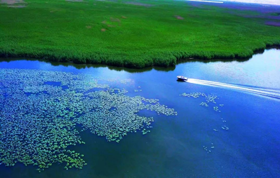
Ahongkou is an important part of Bosten Lake National Wetland Park and the largest inland freshwater lake in China. There are desert,oasis,lake,reeds,lotus pond and other natural landscape,with yachts,speedboats,motor boats,water flying umbrella,water gliding,boating,fishing and other water entertainment projects. The thatched hut on the island,the appearance of primitive rustic,modern facilities,quiet and comfortable leisure environment,make people return to simplicity. Look up at the water platform,like a mirage. On the viewing platform,choose the amusement project,slowly swinging rubber boat,automatic lovers boat,heartbeat water slide board,driving a single motorboat,take an umbrella more visitors feel very exciting,but also can jump into the clear lake to enjoy the water once.
Itinerary
The charming scenery of Ahongkou is the first sight of Bosten Lake,with different reeds,some reflections,some birds in the island in the middle of the lake,quiet and leisurely,the birds in the air,the fish swimming,the lotus blooming,tender and bright.
kindly reminder:
There are more mosquitoes in Bosten Lake scenic area,please prepare mosquito repellent drops in advance.
Day 24 Urmuqi--Heavenly Lake-Urumqi (about 90KM)
Today's scenic spots:
Heaven lake of Tian Shan
There are three water surfaces in the Heavenly Lake,in addition to the main lake,there are two water surfaces on the east and west sides,the east side is the East Little Heavenly Lake,the ancient name of Heilongtan,located 500 meters east of the Heavenly Lake,legend is the face of the Queen Mother. Under the pool for the cliff,there is a waterfall flowing down,just like a rainbow according to the sky,is spectacular,to help a scene day "hanging spring Yao hong". The west side is the West Small Heavenly Lake,also known as the Jade Woman Pool,according to legend that the Queen mother of the West wash feet,located two kilometers northwest of the Heavenly Lake. West small Heavenly Lake like a full moon,the water is clear and deep,surrounded by tower pine. If the bright moon in the sky,the quiet shadow of the wall,the clear scenery is infinite,so also have a scene said: "longtan blue moon". The side of the pool also flies hanging a waterfall,tens of meters high,such as the Milky Way landing,spit beads splash jade,the scene is called "jade belt silver curtain". There is a pavilion on the pool,the pavilion view the waterfall is interesting. Eyes can see the curtain rolling pool tao,pine cui water blue; ears can hear the water through the rock,sound shock rift.
Itinerary
Starting from the hotel parking lot along the Tuwu Expressway to Heavenly Lake Scenic area. After getting off the parking lot for the ticket procedures,all tourists must change the interval car to enter. Every day after 10 a. m.,the bus will stop at the Folk Village. All tourists have to get through the bus from the village to the next boarding point to get on the bus. Along the way,there are selling barbecue,naan,ethnic handicrafts and other stalls. After getting at the parking lot at the top of the mountain,there are 1.5KM,you can walk or take a battery car.
kindly reminder:
1.the scenic spot has strong ultraviolet light during the day,please take sunscreen measures. The lake temperature is not high,but the ultraviolet light penetration is very strong;
2.on the top of the mountain,pay more attention to keep warm (2300 meters above sea level) there are few restaurants in the scenic area,and far away from the door of the scenic spot,so if you want to stay in the scenic area for a long time,to calculate the good time to eat,otherwise you should prepare some dry food to carry.

Day 25 Urumqi--all Your city
Arrange the flight / station according to the flight / train information,end the deep journey of northern Xinjiang,return to the warm home! Welcome to visit Xinjiang again!
The trip time node is for reference only,subject to the actual participants